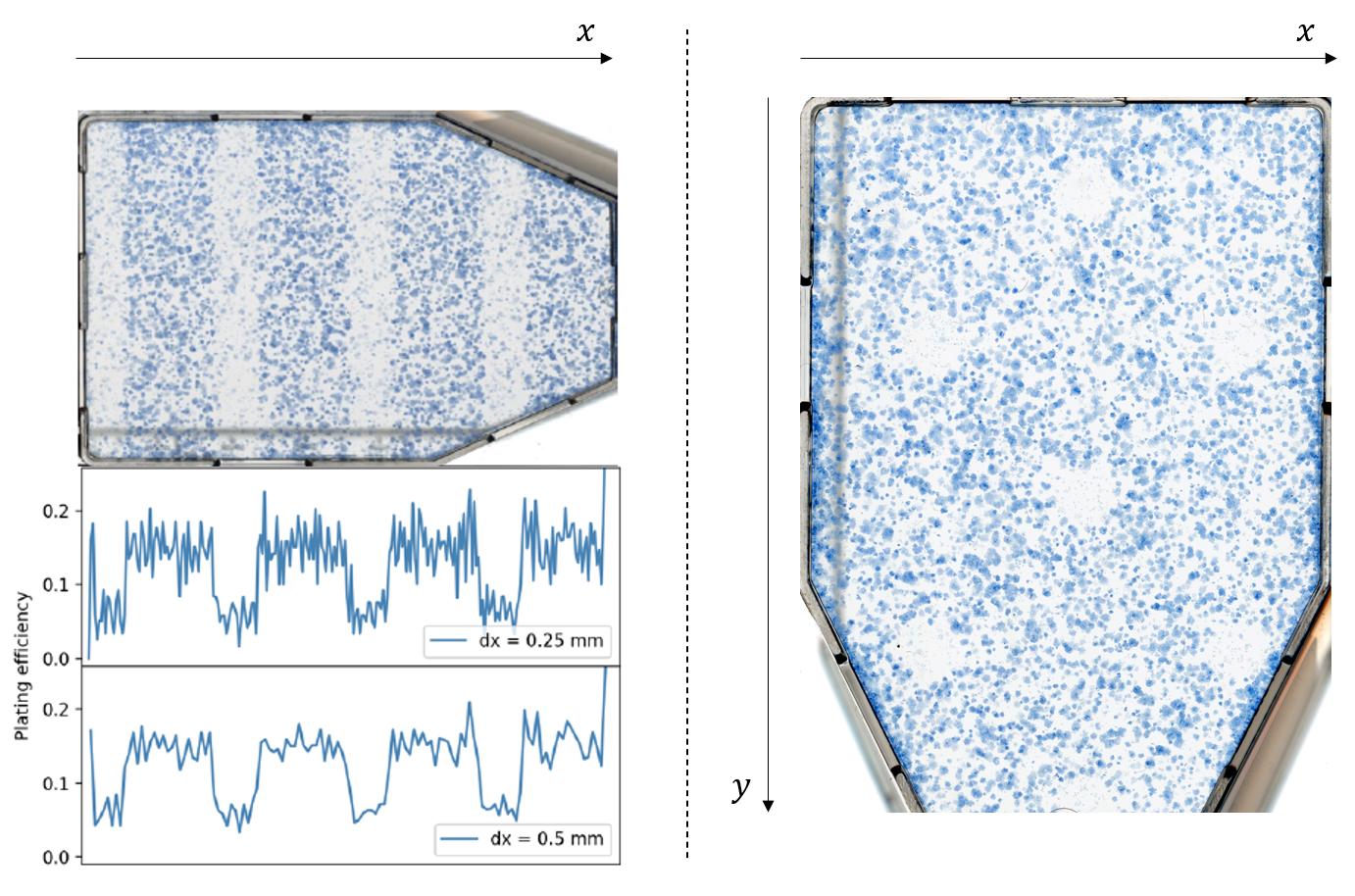
I am attempting to spatially map the cell survival in a given scanned image of a cell flask. Quick background: the cells have received a high dose of irradiation (protons/X-rays) delivered through a grid so that some regions are covered from the irradiation, whereas other regions are not. After scanning such cell colonies, the images are then fed into a segmentation algorithm (in which I have developed using Matlab), centroid coordinates ($c_i = (x_i,y_i)$) of each detected viable colony are provided.
I have done this type of assessment for grid ‘stripes’, where I have counted colonies within a band along a single dimension ($x$) and tested for different band widths $\Delta x$ (as shown in the left figure below). However, my issue is for grid ‘holes’ (see right figure below) – how can I perform the same type of assessment for cell colony survival in two dimensions ($x$ and $y$) given the centroid coordinates? Do I have to “think” radially?
Thank you in advance for any guidance or help to this problem.

